Ice Age National Scenic Trail
Logging is occurring near the eastern end of the Sand Creek Segment from approximately 1.7 miles west of 30th Ave. to 0.8 miles west of 30th Ave. The Trail is adjacent to active logging and enters the logging area in several spots. Trucks may use the logging road, and conditions Details
Flooding may occur between Mill Rd. and Nuclear Rd., especially in spring or after heavy rain. A bypass is available via CTH‑B between CTH‑BB and Nuclear Rd. For maps and additional details from the Ice Age Trail Alliance, follow the link below: Details
Hwy 113 is undergoing a repaving project. The Ice Age Trail remains open, but the Hwy 113 crossing will be temporarily closed during paving work. Expect construction vehicles and limited parking access between CTH‑DL (north side) and Solum Ln. The project is anticipated to contin Details
A timber harvest is under way east of STH‑45 for approximately one mile. Work may continue through mid‑October. Heavy machinery may be present, and conditions may vary. Remain on the Trail and keep dogs leashed. For maps and additional details from the Ice Age Trail Alliance, fol Details
Logging operations are occurring along a 0.3‑mile section of the Trail about 0.2 miles north of Hwy 28. Work may continue into winter. Heavy machinery may be present. Use caution. For maps and additional details from the Ice Age Trail Alliance, follow the link below: Details
A reroute is in effect on the connecting route south of Algoma. The bridge over Three Mile Creek on Longfellow Rd is closed to all travel. Bypass this closure via 9th Rd and STH‑42; note that the 10th Rd bridge is also closed. This 2.7‑mile alternate route replaces 2.8 miles of c Details
A 0.6‑mile section on the western side of the Sand Creek Segment is closed October 15–December 1 for private hunting. Follow posted reroute directions to bypass this area. The 3.9‑mile bypass route replaces 2.4 miles of Ice Age Trail/connecting route. For maps and additional deta Details
A reroute is in effect between Indian Valley Rd and Grenlie Rd from September 1, 2026 to January 5, 2027 due to private hunting. Bypass the closure by heading southwest, then south on N Foley Rd, and turning east on Grenlie Rd. The section between Grenlie Rd and Rieben Rd is also Details
The first 0.4 miles east of Thornapple Creek Rd are closed September 1–December 31 for private hunting. Bypass the closure by heading west, then south on Thornapple Creek Rd, and turning east on Gold Dust Rd. For maps and additional details from the Ice Age Trail Alliance, follow Details
The Ice Age Trail is closed along Effinger Rd for repaving. Follow the posted detour, which directs hikers south from STH‑113 (Water St) on a paved path, then along Mill Race Dr to Manchester St. The closure is anticipated to last until October. For maps and additional details fr Details
A one‑mile section on the eastern side of the Averill‑Kelly Creek Segment is closed October 15–December 31 for private hunting. Follow posted reroute directions. The entire segment is also closed during the 9‑day gun deer season. For maps and additional details from the Ice Age T Details
A 0.1‑mile section of the Ice Age Trail between S Neenah Ave and W Yew St is closed indefinitely. Bypass this closure via S Neenah Ave and W Yew St. This 0.5‑mile alternate route replaces 0.5 miles of Ice Age Trail. For maps and additional details from the Ice Age Trail Alliance, Details
The Stewart Tunnel is closed indefinitely pending reconstruction. The Ice Age Trail is closed at both intersections of Tunnel Rd. Follow Tunnel Rd to bypass the closure and remain on the designated alternate route. For maps and additional details from the Ice Age Trail Alliance, Details
A reroute is in effect between the Emmons Creek Fishery Area and Hartman Creek State Park due to forestry operations. Follow posted signage to remain on the designated reroute. For maps and additional details from the Ice Age Trail Alliance, follow the link below: Details
Construction on the Pike Lake Beach parking lot begins September 29 and continues through early November. Parking will be limited, with about 50 stalls remaining open; expect reduced capacity on weekends. The segment remains open. For maps and additional details from the Ice Age Details
Straight from the US National Park Service, refreshed several times a day.
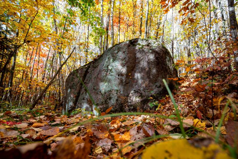
The Ice Age National Scenic Trail is a long-distance hiking trail that spans over 1,200 miles across Wisconsin. It showcases the geological features shaped by glaciers during the last Ice Age, offering a unique perspective on the natural history of the region.
Read more
Travellers come to experience its diverse landscapes, from forests to prairies, and to enjoy the tranquility of the outdoors. The trail is popular among hikers, nature enthusiasts, and those seeking a peaceful retreat in nature.
In pictures
Practical
At a glance
- Opened
- 1980
- Open
- Daily open 24 hours
- Accessibility
- Varies by section, some areas are rugged
- Opening hours
- Daily open 24 hours
- Phone
- 608-798-8700
- Price
- Free
- Website
- www.nps.gov
Things to know
Photo: NPS Photo / Billy Flynn